

Environmental And Land Use Criteria for Evaluation
Numerous factors are considered during the development of a transmission line project. Explore those considerations below.
Land Use

- Length of Alternative Route
- Number of Habitable Structures1 Within 510 Feet of Right-of-Way (ROW) Centerline
- Number of Parcels Crossed by Alternative Route
- Length of ROW Using Existing Transmission Line ROW
- Length of ROW Parallel to Existing Transmission Line ROW
- Length of ROW Parallel to Other Compatible Existing ROW (Highways, Public Roadways, Railways, etc. — Excluding Pipelines)
- Length of ROW Parallel to Apparent Property Lines
- Percentage of ROW Parallel to Existing Compatible Corridors and Apparent Property Boundaries (Excluding Pipelines)
- Length of ROW Through Parks/Recreational Areas
- Number of Parks/Recreational Areas Crossed by ROW Centerline
- Number of Additional Parks/Recreational Areas Within 1,000 Feet of ROW Centerline
- Length of ROW Through Cropland
- Length of ROW Through Pasture/Rangeland
- Length of ROW Through Land Irrigated by Traveling Systems (Rolling or Pivot Type)
- Number of Transmission Pipeline Crossings
- Number of Transmission Line Crossings
- Number of U.S. and State Highway Crossings
- Number of Farm-to-Market Road Crossings
- Number of Cemeteries Within 1,000 Feet of the ROW Centerline
- Number of Federal Aviation Administration (FAA) Registered Airports With At Least One Runway More Than 3,200 Feet In Length Located Within 20,000 Feet of the ROW Centerline
- Number of FAA Registered Airports Having No Runway More Than 3,200 Feet In Length Located Within 10,000 Feet of the ROW Centerline
- Number of Private Airstrips Within 10,000 Feet of the ROW Centerline
- Number of Heliports Within 5,000 Feet of the ROW Centerline
- Number of Commercial AM Radio Transmitters Within 10,000 Feet of the ROW Centerline
- Number of FM Radio Transmitters, Microwave Towers, and Other Electronic Installations Within 2,000 Feet of the ROW Centerline
- Number of Recorded Water Wells Within 200 Feet of the ROW Centerline
- Number of Recorded Oil and Gas Wells Within 200 Feet of the ROW Centerline
Aesthetics

- Estimated Length of ROW Within the Foreground Visual Zone2 Of U.S. and State Highways
- Estimated Length of ROW Within the Foreground Visual Zone2 of Farm-To-Market Roads
- Estimated Length of ROW Within the Foreground Visual Zone2 of Parks/Recreational Areas
Ecology

- Length of ROW Through Upland Woodlands
- Length of ROW Through Bottomland/Riparian Woodlands
- Length of ROW Across Mapped National Wetland Inventory Wetlands and Playas
- Length of ROW Across Known Habitat of Federally Listed Endangered or Threatened Species
- Length of ROW Across Open Water (Lakes, Ponds)
- Number of Stream Crossings
- Length of ROW Parallel (Within 100 Feet) to Streams
- Length of ROW Across 100-Year Floodplains
Cultural Resources

- Number of Archeological or Historical Sites Crossed by ROW
- Number of Additional Archeological or Historical Sites Within 1,000 Feet of ROW Centerline
- Number of National Register of Historic Places Listed Properties Crossed by ROW
- Number of Additional National Register of Historic Places Listed Properties Within 1,000 Feet of ROW Centerline
- Length of ROW Across Areas of High Archeological Site Potential
1 Single-family and multi-family dwellings and related structures, mobile homes, apartment buildings, commercial structures, industrial structures, business structures, churches, hospitals, schools, or other structures normally inhabited by humans or intended to be inhabited by humans on a regular basis. 2 One-half mile, unobstructed.
Structures
Several structure types are being proposed for this project.*
Double Circuit Tangent
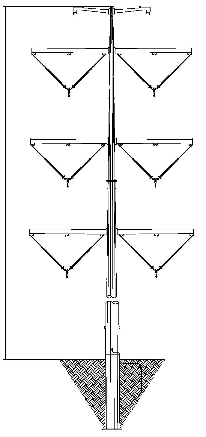
- Typical ROW Width: 120 Feet
- Approximate structure height: 130 to 150 feet
Double Circuit 2-Pole Dead End
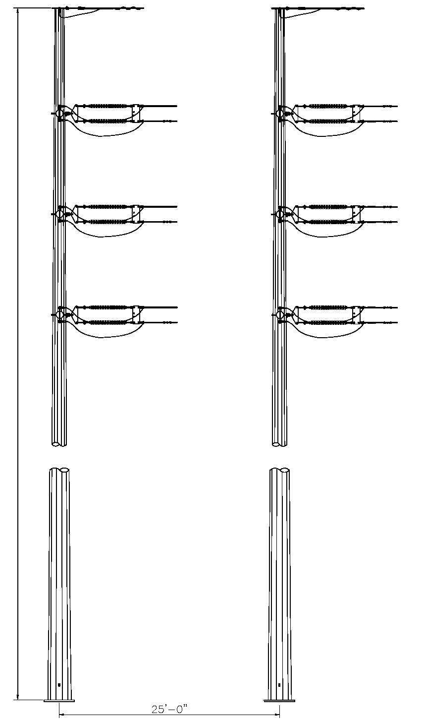
- Typical ROW Width: 120 Feet
- Approximate structure height: 130 to 150 feet
Governmental Agencies and Officials Contacted
- Federal Aviation Administration
- Federal Emergency Management Agency
- Natural Resources Conservation Service
- U.S. Army Corps of Engineers
- U.S. Department of Defense Military Aviation and Installation Assurance Siting Clearinghouse
- U.S. Environmental Protection Agency
- U.S. Fish and Wildlife Service
- Texas Commission on Environmental Quality
- Texas Historical Commission
- Texas Water Development Board
- Texas General Land Office
- Texas Parks and Wildlife Department
- U.S. House of Representatives
- U.S. Senate
- Texas Senate
- Texas House of Representatives
- Burleson County Historical Commission
- Milam County Historical Commission
- Robertson County Historical Commission
- Brazos County Historical Commission
- Railroad Commission of Texas
 Federal Aviation Administration
 Federal Emergency Management Agency
 Natural Resources Conservation Service
 U.S. Army Corps of Engineers
 U.S. Department of Defense Military Aviation and Installation Assurance Siting Clearinghouse
 U.S. Environmental Protection Agency
 U.S. Fish and Wildlife Service
 Texas Commission on Environmental Quality
 Texas Historical Commission
 Texas Water Development Board
 Texas General Land Office
 Texas Parks and Wildlife Department
 U.S. House of Representatives
 U.S. Senate
 Texas Senate
 Texas House of Representatives
 Railroad Commission of Texas

- Texas Department of Transportation (TxDOT)
- TxDOT Bryan District
- TxDOT Division of Aviation
- TxDOT Environmental Affairs Division
- TxDOT Planning & Programming
- Milam County
- Robertson County
- Brazos County
- Burleson County
- City of Hearne
- City of Bremond
- City of Franklin
- City of Calvert
- City of Caldwell
- City of Bryan
- City of Kurten
- Wixon Valley
- Bryan/College Station Metropolitan Planning Organization
- Brazos Valley Council of Governments
 Milam County
 Robertson County
 Brazos County
 Burleson County
 City of Hearne
 City of Franklin
 City of Calvert
 City of Caldwell
 City of Bryan
 City of Kurten
 Wixon Valley
 Bryan/College Station Metropolitan Planning Organization
 Brazos Valley Council of Governments
- Mumford ISD
- Bremond ISD
- Caldwell ISD
- Gause ISD
- Hearne ISD
- Calvert ISD
- Bryan ISD
 Mumford ISD
 Bremond ISD
 Caldwell ISD
 Gause ISD
 Hearne ISD
 Calvert ISD
 Bryan ISD
Proposed Timeline
Project activities will occur between November 2025 - January 2030.*

November 2025 - January 2027
Routing Study, Environmental Assessment, and Public Meeting
February 2027 - August 2027
File Amendment Application for CCN and PUCT Review
August 2027
PUC Approval
September 2027 - December 2028
ROW Activities
January 2029 - January 2030
Transmission ConstructionConstruction Timing/Methods
TNMP and BTU plan to file the CCN application with the Public Utility Commission of Texas in February 2027. The PUCT must approve or deny the application no later than 180 days after filing, although a final order may be issued earlier. Following PUCT approval and completion of right-of-way acquisition, final design, permitting, and other preconstruction activities, transmission-line construction is anticipated to begin in January 2029. TNMP and BTU anticipate completing the project in 2030.

Surveying
Surveying of the proposed transmission line ROW is required to locate the centerline, the structure locations, obstacles above and below ground, and the edges of both new and existing ROW. Environmental surveys are also conducted during this time as needed.
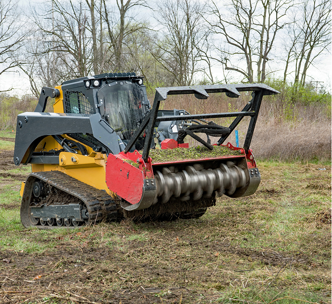
Clearing
Tree and shrub clearing may be needed in areas where new ROW is acquired for safe operation of the line. If a Stormwater Pollution Prevention Plan (SWPPP) is required, it will be implemented along the approved route prior to the start of clearing. Mechanized cutters and hand tools may be used to remove vegetation that interferes with construction or safe operation to ground level.
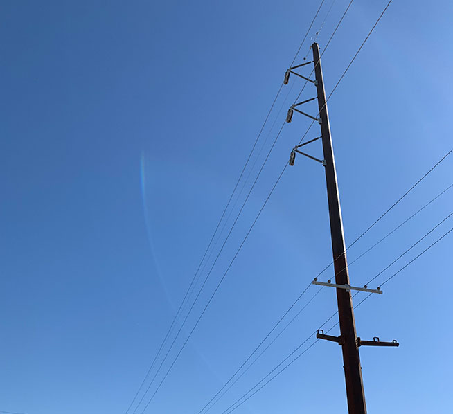
Conductor & Static Wire Installation
Once the structures have been erected, the stringing and clipping-in of conductors and static wires will begin. Outages on transmission lines are a possibility during the conductor and static wire installation. Each road crossing will have temporary guard poles installed for public protection while stringing in the new conductors.
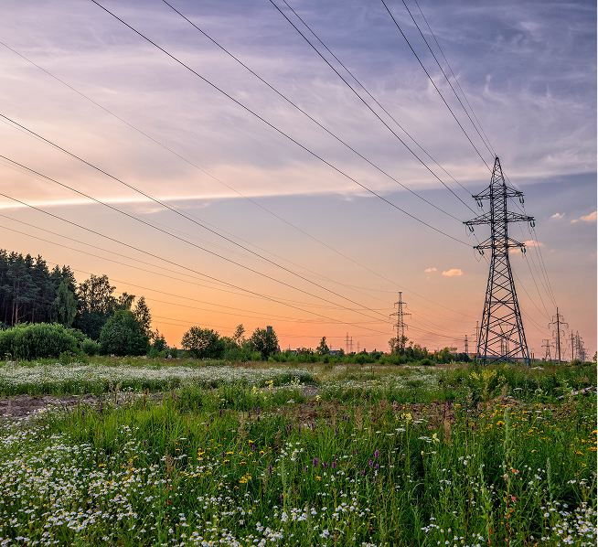
Cleanup
Cleanup operations will be performed as construction activities are completed. Cleanup includes removal of debris, unused materials, and trash. Any necessary soil stabilization and reestablishing of vegetative cover will also occur during cleanup, following the procedures dictated in the SWPPP, if required. Pre-construction contours will also be restored following construction.
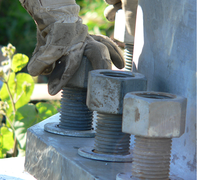
Structure Placement
Specialized wide-track vehicles and line trucks with trailers will be used to transport construction materials along the ROW to the structure locations.
Steel poles will be delivered to the site shortly before the poles are ready to be set. A large crane would then set the pole directly into an excavated hole. The hole will be backfilled with native soil or crushed limestone.
If needed for the dead-end and angled structures, concrete foundations will be installed several weeks before the steel poles are erected to allow the foundations to cure and reach their maximum strength. The steel poles will be delivered and set next to the proposed structure location shortly before structure erection. The structures will be assembled on-site, and a crane will be used to set the sections into place onto the previously installed foundations.
Open House Questionnaire
Thank you for taking the time to learn about the TNP1-RELLIS 345 kV Transmission Line Project. Please take a moment to complete the questionnaire below and submit your comments. Your insights and ideas help our project team develop the best solutions for system improvements. Please share your input by August 21, 2026.
 Landowner Bills of Rights - English